
Table of Contents
In the race for global positioning, navigation, and timing (PNT) supremacy, China has quietly built a formidable infrastructure that threatens to eclipse the U.S.-owned Global Positioning System (GPS). By integrating the BeiDou satellite constellation, a robust eLoran network, and a fibre-optic timing grid, China has created a resilient “PNT triad” designed to outperform GPS in accuracy, reliability, and resilience, particularly in contested environments. This strategic leap, born from a historical reliance on GPS exposed during the 1996 Taiwan Strait Crisis, positions Beijing with a critical edge in both civilian and military domains. Here’s a comprehensive look at China’s PNT ecosystem and its implications for global power dynamics.
The Evolution of China’s PNT Ambitions
From GPS Dependency to BeiDou’s Rise
China’s push for PNT independence began in the 1990s, catalyzed by the “unforgettable humiliation” of the 1996 Taiwan Strait Crisis. During this incident, the People’s Liberation Army (PLA) fired DF-15 missiles, only to see two veer off course, possibly due to disrupted GPS signals—a system China relied on at the time. This vulnerability spurred the development of the BeiDou Navigation Satellite System, launched in 2000 with the regional BeiDou-1. By 2020, BeiDou-3 achieved global coverage, rivaling GPS, Russia’s GLONASS, and Europe’s Galileo. Today, BeiDou is a cornerstone of China’s PNT infrastructure, serving over 1.4 billion devices and generating significant economic impact.
A Strategic Response to GPS Vulnerabilities
GPS, operational since 1993, is the backbone of global PNT, guiding everything from smartphones to military operations. However, its weak signals are susceptible to jamming and spoofing, as seen in the 2019 Shanghai Port “circle spoofing” incident, where ships reported false GPS coordinates. China, aware of these weaknesses, has exploited them—demonstrating GPS interference near Hainan Island and the South China Sea—while building a PNT system immune to such disruptions. Beijing’s 2017 interoperability agreement with GPS allows it to mimic or manipulate GPS signals, further amplifying its electronic warfare capabilities.
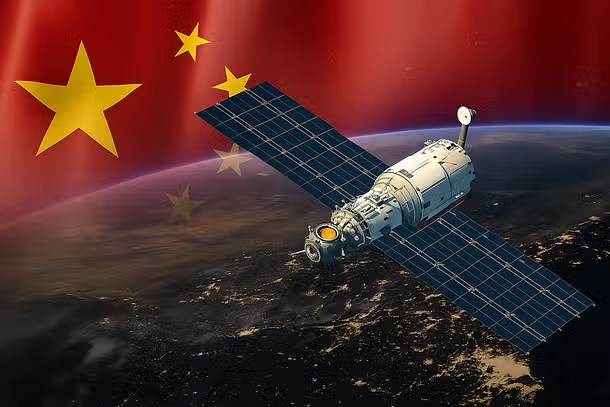
The BeiDou Satellite Constellation: A Global Powerhouse
Scale and Structure
As of 2025, BeiDou’s constellation comprises 56 satellites—nearly double GPS’s 31—across three orbits: 24 in medium Earth orbit (MEO) for global coverage, three in geostationary orbit (GEO) for Asia-Pacific stability, and three in inclined geosynchronous orbit (IGSO) for enhanced regional accuracy. This multi-orbit design ensures robust signal availability, even in urban or mountainous areas, and reduces the impact of satellite loss. In contrast, GPS relies solely on MEO satellites, making it more vulnerable to synchronized attacks. BeiDou’s 120+ ground monitoring stations, compared to GPS’s 11, provide superior real-time oversight and rapid response to anomalies.
Advanced Capabilities
BeiDou outperforms GPS in several metrics. In 2024, it achieved 100% service availability, signal-in-space accuracy of 0.9 meters, and dual-frequency positioning accuracy better than 3 meters globally. Its unique two-way messaging allows short message communication in areas without cellular coverage, supporting applications like search and rescue. China is also developing a low Earth orbit (LEO) constellation, CentiSpace, with 10 satellites launched in January 2025. LEO signals, stronger and harder to jam, aim for decimeter-level accuracy by 2035, further widening BeiDou’s lead.
eLoran: A Robust Terrestrial Backup
Reviving a Cold War Technology
Recognizing satellite vulnerabilities, China has modernized eLoran, a low-frequency radio navigation system, as a GPS-independent fallback. Unlike GPS’s weak signals, eLoran’s high-power pulses travel 1,500–2,000 km, penetrating buildings and water, making it ideal for urban and maritime use. By 2024, China’s eLoran network included 20 primary transmission sites and 270+ timing nodes, covering the entire country, including the Taiwan Strait. This infrastructure ensures continuity if satellites are compromised, a capability the U.S. abandoned when it dismantled its Loran-C network in 2010.
Technical Superiority
eLoran’s digital signals, synchronized with Coordinated Universal Time, deliver timing precision under 100 nanoseconds and positioning accuracy of 10–20 meters. Its distinct pulse patterns resist jamming and spoofing, unlike GPS’s continuous signals. Integrated with BeiDou and fibre networks, eLoran-equipped multi-mode receivers seamlessly switch to the most reliable signal source, ensuring uninterrupted PNT services. This resilience is critical for critical infrastructure like data centers and military bases.
Fibre-Optic Timing Grid: The Backbone of Precision
A Nationwide Network
China’s fibre-optic timing grid, spanning 20,000 km and connecting 294 timing stations, distributes ultra-precise time from atomic clocks, achieving accuracy under 100 picoseconds. This network supports critical sectors like finance, telecommunications, and energy, where precise timing is essential for transaction timestamps and grid synchronization. Unlike satellite-based systems, fibre-optic networks are immune to space-based threats, providing a third layer of redundancy.
Integration for Resilience
Advanced PNT fusion algorithms combine data from BeiDou, eLoran, inertial navigation, and fibre networks, optimizing accuracy across applications. This “PNT triad” ensures no single point of failure, as each channel operates independently. For example, if BeiDou satellites are jammed, eLoran and fibre networks maintain functionality, a stark contrast to GPS’s reliance on satellites alone.
Strategic Implications: A Tactical Edge in Conflict
Military Advantage
China’s PNT triad offers a decisive advantage in potential conflicts, particularly over Taiwan. By jamming or spoofing GPS signals, China could disrupt U.S. and allied navigation, targeting, and coordination, while its forces rely on eLoran and BeiDou for uninterrupted PNT. Pakistan’s adoption of BeiDou’s military-grade signals since 2018 exemplifies this shift, enabling precise missile and drone operations. The triad’s resilience could allow China to act swiftly in a conflict’s early stages, potentially tipping the scales before intervention.
Global Influence
China leverages BeiDou as a tool of soft power, offering subsidized equipment and ground stations to developing nations, particularly in Africa and Southeast Asia. Over 120 countries use BeiDou, with 11 sub-Saharan nations hosting Chinese reference stations. This expands China’s economic and diplomatic influence, potentially at the expense of U.S. dominance via GPS. However, concerns linger about espionage risks through Chinese-made receivers, highlighting the dual-use nature of BeiDou’s infrastructure.
The U.S. Response: Playing Catch-Up
GPS Modernization Efforts
The U.S. is upgrading GPS with jam-resistant signals and cybersecurity enhancements, but its next-generation NTS-3 system remains in R&D, with a test satellite delayed until late 2025. The U.S. Space Force aims for 24 L5-equipped satellites but faces launch delays, leaving GPS lagging behind BeiDou in scale and resilience. Proposals to integrate BeiDou as a civilian backup have been floated but face national security concerns.
Alternative PNT Systems
The U.S. is exploring terrestrial backups like eLoran, with the Coast Guard testing it for maritime safety. Commercial efforts, such as Xona Space Systems’ LEO-based Pulsar-0, aim for centimeter-level accuracy, but these are years from operational status. Without a cohesive strategy, the U.S. risks ceding PNT leadership to China, with implications for both economic and military domains.
The Road Ahead: A New PNT Era
China’s PNT triad—BeiDou satellites, eLoran towers, and fibre-optic networks—represents a paradigm shift in global navigation and timing. Its multi-layered resilience, superior accuracy, and strategic deployment give China an edge in contested domains, from the Taiwan Strait to global markets. By 2035, with next-generation BeiDou satellites and expanded LEO constellations, China aims to solidify this lead.
For the U.S., the challenge is clear: modernize GPS, invest in terrestrial backups, and counter China’s soft power push. Failure to do so could see GPS, once the “silent utility,” overtaken by a Chinese system built for both peace and war. As PNT becomes a contested domain, the stakes—economic, military, and geopolitical—couldn’t be higher.
What do you think about China’s PNT advancements? Can the U.S. regain its edge, or is BeiDou set to dominate the future of navigation and timing?